As a young Solution Consultant for the Utilities sector at Esri Indonesia, Rifqi Oktavianto has carved for himself a distinctive path in the world of geospatial technology, delivering impactful solutions and shaping the future of how critical infrastructure is managed across Indonesia.
Having joined Esri Indonesia in late 2019, Rifqi brings close to six years of experience as a trusted advisor in translating complex challenges into powerful strategies driven by geospatial mapping technology. He shares, “My days are dynamic and highly collaborative. My primary goal is to bridge the gap between complex customers’ challenges and Esri's powerful geospatial solutions, demonstrating how our technology can drive efficiency, improve decision-making, and enhance overall operations.”
From Jamboree Maps to Cutting-Edge GIS
Rifqi’s fascination with geospatial data began long before his professional career. It was during a National Jamboree in junior high school where he first encountered manual map reading. However, it wasn’t until university, while studying Geomatics Engineering, that he discovered the advantages of utilising Geographic Information Systems (GIS).
GIS is a technology that is used to create, manage, analyse, and map various types of data. GIS connects data to a map, integrating location data with all types of descriptive information to help users understand patterns, relationships, and geographic context.
In 2019, Rifqi participated in the Esri Young Scholar Award (EYSA) competition, where he won first place. Winning the competition earned him the opportunity to attend Esri’s User Conference in San Diego. “The competition opened a door for me into the world of geospatial technology,” he says. “Subsequently, when a Solution Engineer position opened at Esri Indonesia, I applied and was accepted. That was the start of my career at Esri Indonesia.”
In February 2025, Rifqi achieved a professional milestone by becoming the first Indonesian to be certified in ArcGIS Utility Network. As a certified ArcGIS professional, Rifqi is recognised as an expert in using Esri’s ArcGIS platform, which is the industry standard for GIS. “Personally, it's an accomplishment I’m proud of and it validates the effort I've dedicated to mastering this complex technology,” Rifqi shares. “Professionally, it enhances my credibility with clients, assuring them they are collaborating with someone at the forefront of Utility Network solutions.”
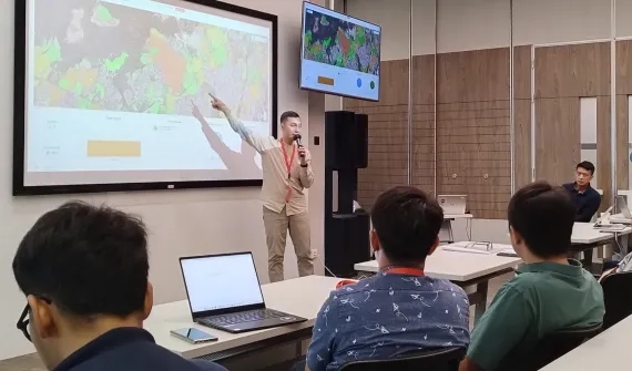
Rifqi’s presentation titled “Navigating disruption with the power of location intelligence” at the GeoInnovation Indonesia 2024 awards ceremony. Note: Click the Closed Caption (CC) icon and select ‘Auto-translate’ to show English subtitles.
Geospatial Solutions for a Challenging World
As the world grapples with pressing issues such as urbanisation, climate change, and infrastructure strain, Rifqi believes GIS is more relevant than ever. “Geospatial technology offers a critical lens for understanding and solving the myriad challenges we face today, by revealing the inherent ‘where’ in nearly every ‘what’ and ‘why’,” he explains.
In one such case, Rifqi was involved in a project where GIS was used to spatially locate electrical equipment near areas where natural disasters are most likely to occur. This provided better insight for PT Perusahaan Listrik Negara, Indonesia’s state-owned electric utility company by mapping areas of high external risk with assets needing maintenance or repair.
From urban planning and climate monitoring to public health, agriculture, and logistics, Rifqi sees GIS as a transformational technology that allows utility companies to visualise, analyse, and manage their infrastructure, assets, and spatial data more effectively, leading to increased efficiency, reduced costs, and improved service delivery.
Looking ahead, Rifqi is most excited about the acceleration of GeoAI (integration of Geospatial and AI) and real-time intelligence across Southeast Asia. “GIS is becoming the foundational framework for connecting disparate data, enabling real-time decision-making, and driving intelligence for everything from national development initiatives to localised community services,” he says.
“GeoAI promises automated insights, predictive analytics for proactive problem-solving, and the ability to process the massive influx of spatial data generated by sensors, drones, and satellites. This means a shift from reactive analysis to truly intelligent, foresight-driven strategies.”
When asked what it takes to thrive in geospatial solutions, Rifqi immediately honed in a few qualities. He elaborates, “Problem-solving capabilities and an analytical mindset are crucial. However, equally important is the ability to communicate technical details in a way that resonates with business stakeholders. That’s how trust is built, and that’s how projects succeed.”
For more information about Boustead’s Geospatial Division, visit boustead.sg/geospatial
Interested in learning more about our people, or becoming part of the Boustead group? Take a look at our Careers page.